Asia
- Japan
(1) underground street
The top 5 underground streets of total construction area in Japan in 2005
| No. | underground street | location | area (2005) | commercial area (2005) | commercial area/construction area |
| 1 | Crystal Nagahori | Central District of Osaka | 81765 | 9500 | 12% |
| 2 | Yaesu Underground Street | Chuo-ku, Tokyo | 73253 | 13787 | 19% |
| 3 | Kawasaki azalea | Kawasaki Ward,Kawasaki,Kanagawa Prefecture | 56704 | 24648 | 43% |
| 4 | Central Park Underground Street | Nagoya, Aichi Prefecture | 56370 | 10250 | 18% |
| 5 | Osaka Media Center (Osaka Station Diamond Underground Street) | North of Osaka | 42977 | 8000 | 19% |
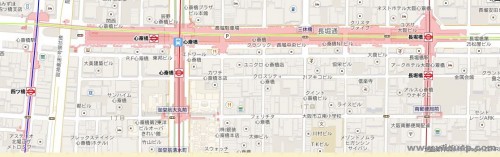
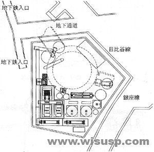
Crystal Nagahori underground street
Nagahori underground street,with a total length of 730 meters, with a total area of 81,765 square meters (including underground parking), is most wide underground street in Japan, known as “Crystal Nagahori.” Four bridges connecting the subway station, Shinsaibashi station, Nagahoribashi station, the traffic is very convenient, one-third of the ground in the region has skylight, there is sunlight into the ground, combined with groundwater to show its features.
plan of Crystal Nagahori |
||
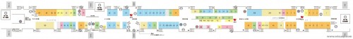
internal layout of Crystal Nagahori |
||

location map of underground parking of Crystal Nagahori |
||
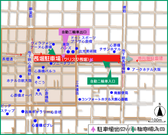 underground parking entrance map of Crystal Nagahori underground parking entrance map of Crystal Nagahori |
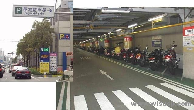 motorcycle and non-motorized vehicles figure of Crystal Nagahori motorcycle and non-motorized vehicles figure of Crystal Nagahori |
|
(2)common ditch
Common ditch construction is very large scale in Japan, 49 cities build underground utility tunnel with a total length of over 300 kilometers, Japan plans to reach more than 500 kilometers at the beginning of the 21st century.
common ditch construction data sheet
| common name | location | length (m) | construction year | reception facilities |
| Takanawa | Minato-ku & Shinagawa,Tokyo | 1999 | 1965-1966 | T,E,N |
| Aoto, Katsushika | Katsushika, Tokyo | 2300 | 1971-1975 | T,E,G,N |
| Nerima | Nerima,Tokyo | 2299 | 1973-1977 | T,E,G,W,N |
| Kameido | Sumida,Tokyo | 2039 | 1981-1989 | T,E,N |
| Kawasaki | Kawasaki Ward,Kawasaki &Tsurumi-ku, Yokohama | 2723 | 1976-1983 | T,E,G,W,N |
| East Terao | Kanagawa & Tsurumi-ku, Yokohama | 4561 | 1979-1988 | T,E,W,N |
| Yoshino-cho, roller | Roller District & Southern District,Yokohama | 2600 | 1990- | T,E,G,W,S,N |
| KARASUMA | Under Bunkyo,Kyoto | 520 | 1976-1979 | T,E,W |
| Five | Under Bunkyo,Kyoto | 1514 | 1979-1985 | T,E |
| Second Amagasaki | Amagasaki,Hyogo | 2476 | 1980-1988 | T,E,G |
| Kobe | Chuo-ku & Hyogo,Kobe | 3280 | 1987- | T,E,G,S |
| Fukushima | Fukushima & North, Osaka | 2369 | 1982- | T,E,G,W |
| Lake-ku | Fukushima District & West Yodogawa,Osaka | 3708 | 1988- | T,E,G,W |
| PS:T-Telegraph and Telephone G-Gas W-Waterworks S-Sewer E-Electric power N-Tokyo Communication Network | ||||
Hibiya common ditch-(www.notbad.cn)
Hibiya common ditch tectonics from Humen paragraph 1 until Chiyoda under Yurakucho State Route 1 until 1 segment, Humen work well as a departure point, via Sakurada work well, Sunday Hibiya work well, with a length of 1423m shield tunnel (tunnel inner diameter φ6,700mm), is constructed by slurry shield machine, the tunnel overburden is 35m at the originating part; 23m at the destination part .

Azabu Hibiya common ditch plan |
||

Geological profile view |
||
 Humen work well plan on the ground floor Humen work well plan on the ground floor |
 Humen work well plan under pavement floor Humen work well plan under pavement floor |
.jpg) Slurry shield machine (φ7470mm) Slurry shield machine (φ7470mm) |
(3)underground road
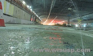
Yokohama ring North line-(radiate.jp)
Yokohama ring North line connects the third Keihin Road Kohoku IC (Port North Interchange) and Metropolitan Expressway Yokohane line Namamugi JCT (Namamugi crossing) highway, the total length is 8.2 kilometers.
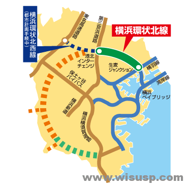 Yokohama ring North line location map Yokohama ring North line location map |
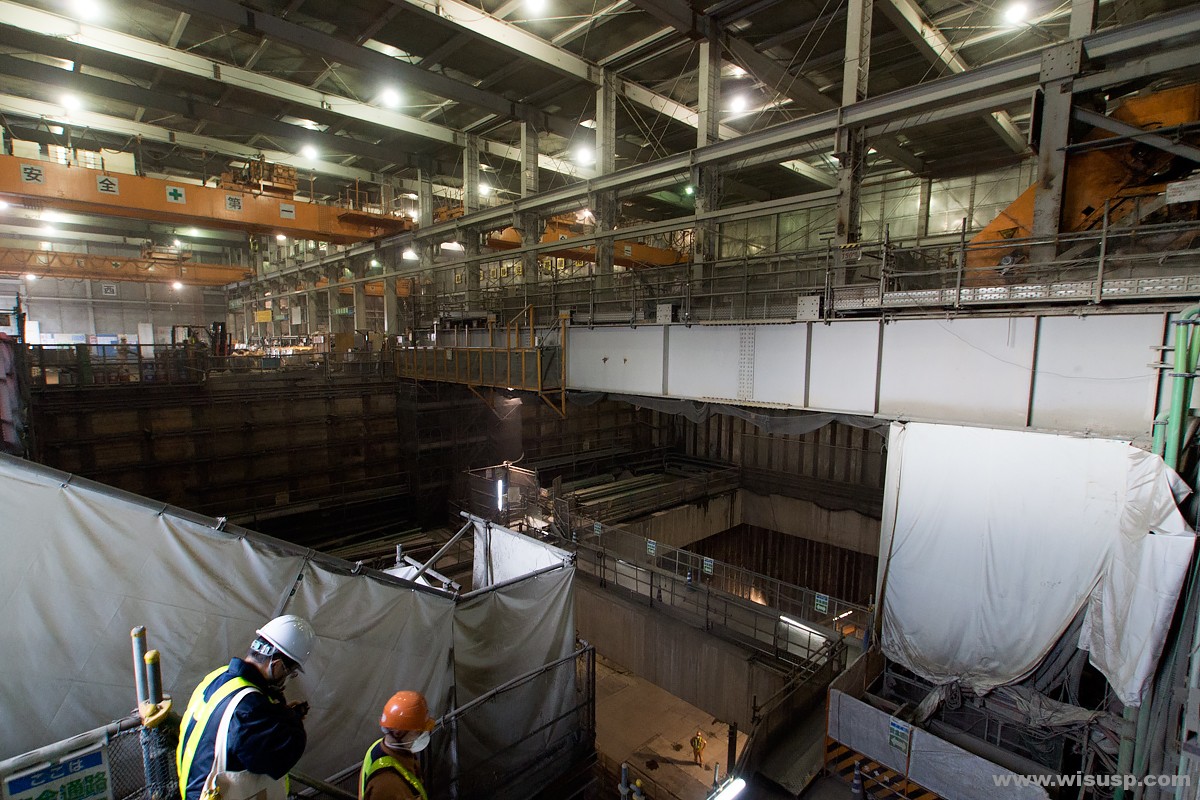 Yokohama ring North line interior photo (1) Yokohama ring North line interior photo (1) |
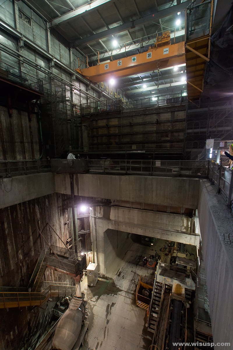 Yokohama ring North line interior photo (2) Yokohama ring North line interior photo (2) |
 Yokohama ring North line interior photo (3) Yokohama ring North line interior photo (3) |
 Yokohama ring North line interior photo (4) Yokohama ring North line interior photo (4) |
 Yokohama ring North line interior photo (5) Yokohama ring North line interior photo (5) |
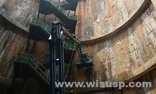
(4) Capital peripheral drainage system (Capital Juan bulwarks drainage channel)-(ktr.mlit.go.jp)
Beginning construction in 1992,the metropolitan periphery drainage system established by series of concrete pits, each of which has a 65-meter-high concrete pit stand (about 22 floors high), 32 meters wide, at 50 meters deep, picked up by the 6.3 km-long tunnel, in addition, there is a huge surge tank: 25.4 meters tall (about eight floors), 177 meters long, 78 meters wide, there are 59 concrete pillars inside, with a total storage capacity of 670,000 cubic meters, maximum displacement of 200 cubic meters per second by 14,000 horsepower turbine, until the completion of 2006, known as the world’s most advanced sewer drainage system, the drainage standard is “a case of five to ten years,” constituted by series of concrete pit stand, the depth of underground river is 60 meters.
2.Singapore
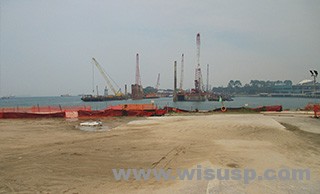
(1)Jurong rock cavern
It is the first underground petroleum and petrochemical products storage facilities in Southeast Asia.
 Jurong Rock Cave – underground oil storage (1) Photographer: Bryan van der Beek / Bloomberg Jurong Rock Cave – underground oil storage (1) Photographer: Bryan van der Beek / Bloomberg |
 Jurong Rock Cave – underground oil storage tanks (2) Photographer: Bryan van der Beek / Bloomberg Jurong Rock Cave – underground oil storage tanks (2) Photographer: Bryan van der Beek / Bloomberg |
 Jurong Rock Cave – underground oil storage tanks (3) -Photo JTC Jurong Rock Cave – underground oil storage tanks (3) -Photo JTC |
 Jurong Rock Cave – underground oil storage tanks (4) -Photo JTC Jurong Rock Cave – underground oil storage tanks (4) -Photo JTC |
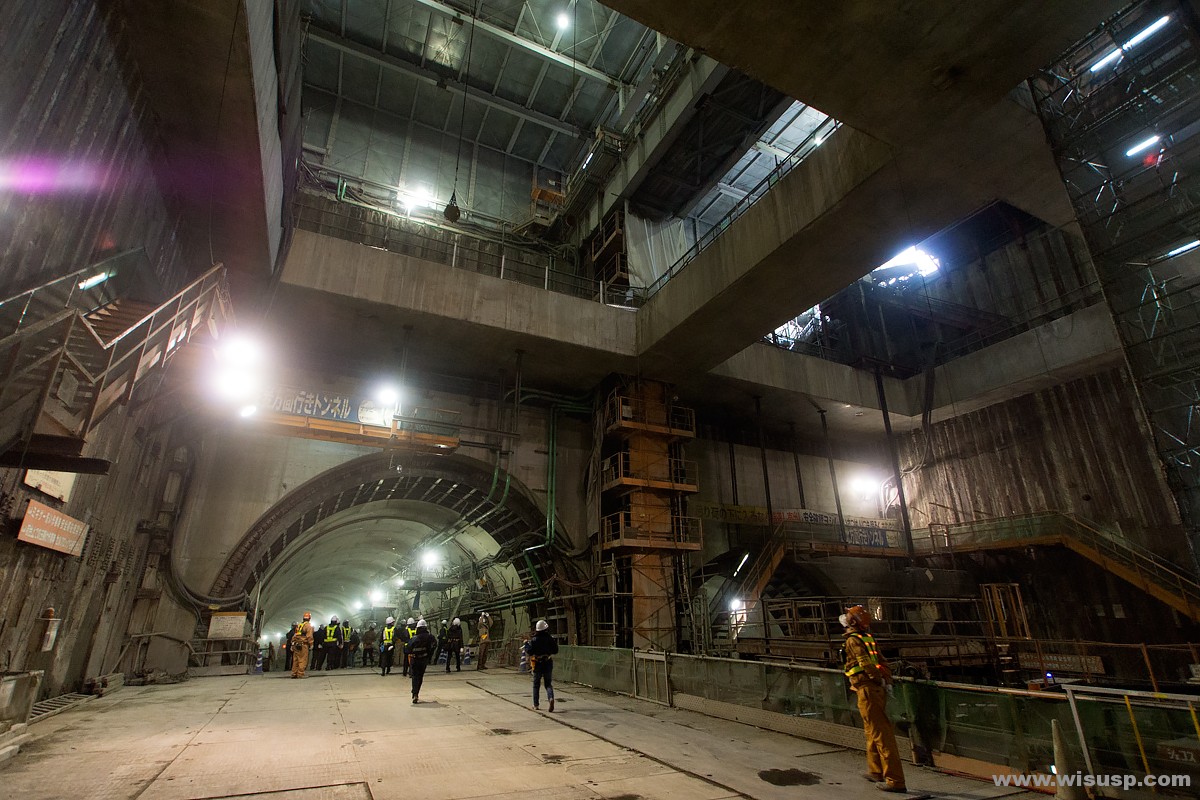
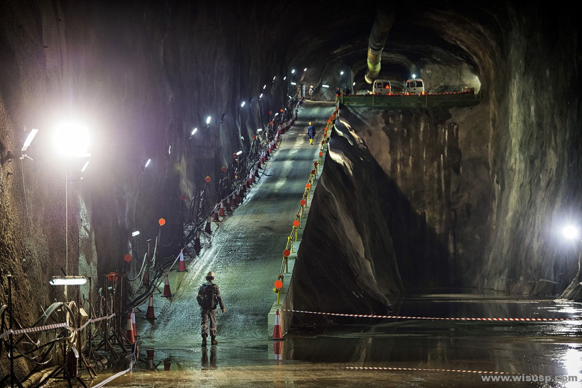
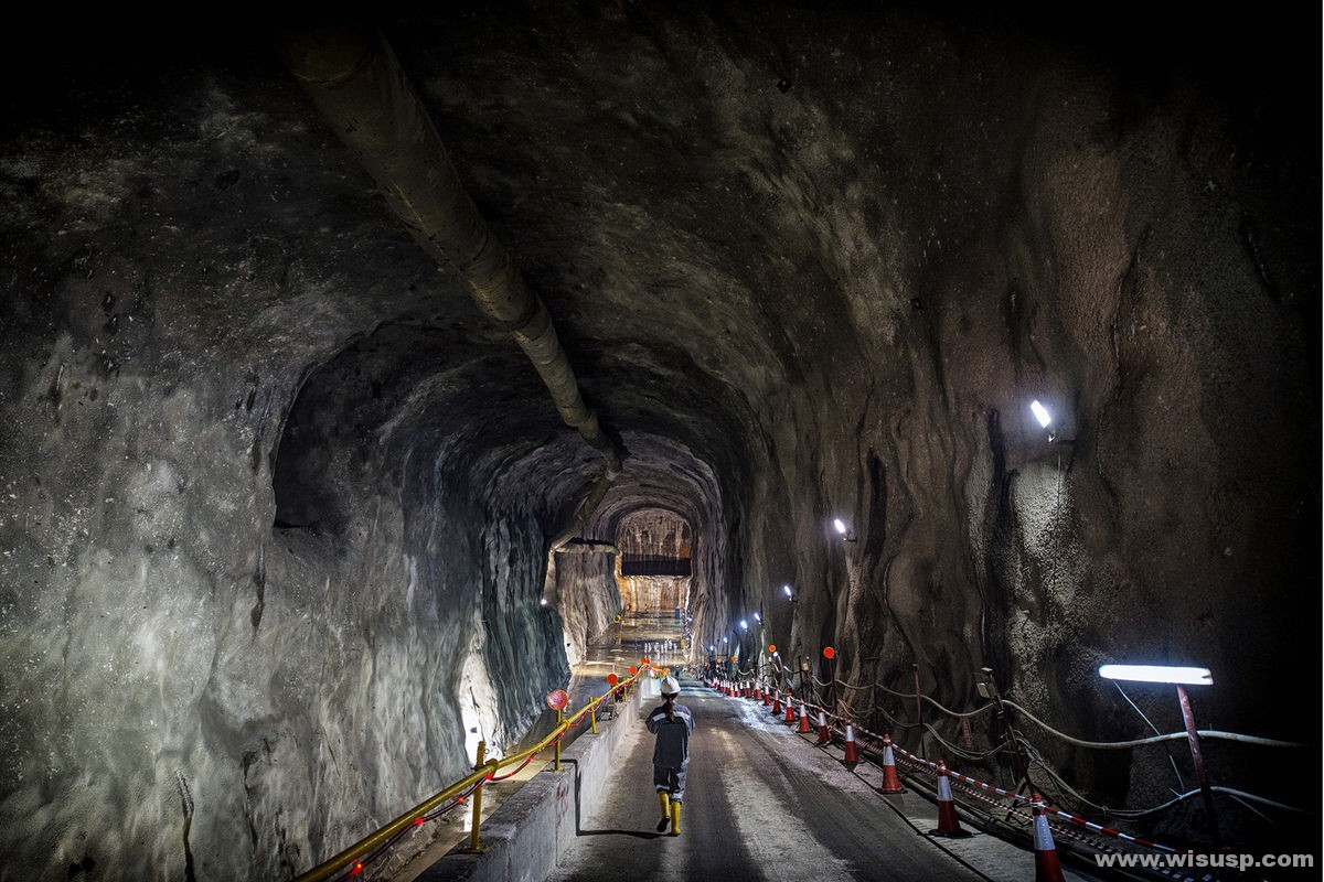
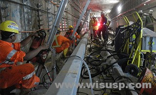
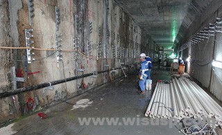
(2)deep cable tunnel-(singaporepower.com)
Depth of 60m, totaling 35 km, constructed by drilling and blasting, and a combination of the TBM. North-South tunnel is from Gambas to May Road, totaling 18.5 km; East-West tunnel is from Ayer Rajah to Paya Labar, totaling 16.5 kilometers. We expected to be completed by the end of 2018.
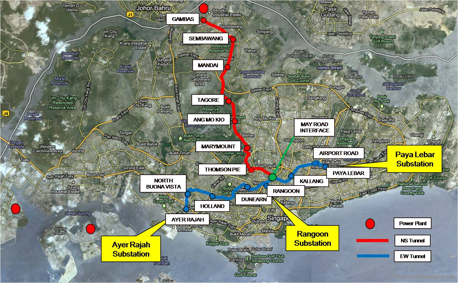 Alignments plan Alignments plan |
 Interior photos (1) – (sovereignsingapore.com) Interior photos (1) – (sovereignsingapore.com) |
 Interior photos (2) – (sovereignsingapore.com) Interior photos (2) – (sovereignsingapore.com) |
 Interior photos (3) – (sovereignsingapore.com) Interior photos (3) – (sovereignsingapore.com) |
 Interior photos (4) – (sovereignsingapore.com) Interior photos (4) – (sovereignsingapore.com) |
 Interior photos (5) – (sovereignsingapore.com) Interior photos (5) – (sovereignsingapore.com) |